Sao Tome and Principe
Where is it?

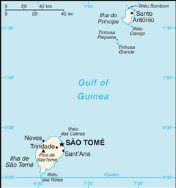
Country Map
Country Flag
   Â
Geography
   Â
|
Continent:
|
Africa |
|
Area:
|
1,001 sq km OR 386 sq mi |
|
Coastline:
|
209 km OR 130 mi |
|
Elevation extremes:
|
lowest point: 0 m OR 0 ft highest point: 2024 m OR 6,640 ft |
   Â
Population
   Â
|
Population:
|
190,344 (2010) |
|
Population growth rate:
|
2.13% (2010) |
|
Population density:
|
190 per sq km OR 492 per sq mi |
|
Urban vs Rural Population:
|
Urban: 65.10% Rural: 34.90% |
|
Life Expectancy:
|
63.11 (2010) |
|
Infant Mortality:
|
53.21 (2010) |
|
Birth Rate:
|
33.9 per 1000 (2010) |
|
Death Rate:
|
6.5 per 1000 (2010) |
|
Overall Literacy:
|
84.90% (2010) |
|
Male Literacy:
|
92.20% (2010) |
|
Female Literacy:
|
77.90% (2010) |
   Â
Government
   Â
|
Capital:
|
Săo Tomé |
|
Official Language(s):
|
Portuguese |
   Â
Economy
   Â
|
GDP Per Capita:
|
$3,153 |
|
Currency:
|
Dobra |
Top
 Back to Country List